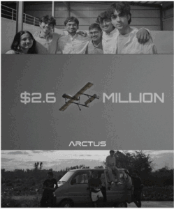
We’re excited to share that Arctus Aerospace has raised a $2.6M pre-seed round, led by Version One Ventures alongside South Park Commons, gradCapital, and a group of angels including Balaji Srinivasan and Srinivas Narayan of OpenAI.
Arctus is building something rare: a fundamentally new category of high-altitude, long-endurance autonomous aircraft for real-time Earth observation. Their unmanned platforms fly up to 45,000 feet, stay airborne for over 24 hours, carry 250 kg payloads, and deliver centimetre-level, real-time geospatial data—all without relying on expensive satellite infrastructure.
This is zero-infrastructure Earth intelligence, delivered from the stratosphere.
Why we invested
Arctus’ founder and CEO, Shreepoorna S. Rao, has been building drones since high school, long before “autonomous aviation” became a buzzword. His early work began with hobby aircraft and hand-built flight controllers; that curiosity evolved into increasingly sophisticated UAV systems, composite manufacturing experiments, and long-range autonomy projects.
 By the time Arctus was founded in 2023, Shree had spent more than a decade developing unmanned aircraft systems from the ground up. That depth of hands-on experience—paired with a first-principles engineering mindset—is what makes Arctus so compelling. This isn’t a team retrofitting existing airframes or stitching together off-the-shelf components. They are designing and manufacturing an entire high-altitude aviation stack: airframes, propulsion, avionics, autonomy, and mission systems.
The ability to deploy high-value sensing—SAR, hyperspectral, optical, EO, IR—using aircraft that cost a fraction of satellites fundamentally changes who can access high-resolution data and how often. What typically costs $10,000 to image 500 square km can now be done for around $500. That unlocks new use cases across energy & utilities, infrastructure & construction, climate and environmental monitoring, agriculture, national security, and any industry that needs real-time, high-fidelity geospatial intelligence
Building in Bangalore: Full-Stack Aviation from Day One
Arctus builds everything in-house from its 25,000 sq ft facility in Bangalore—aircraft manufacturing, testing, and operations. They already operate aircraft above 10,000 feet with real-time data streaming and centimetre-level accuracy, proving out key parts of the platform as they scale toward stratospheric flight.
This full-stack approach is what allows the team to tightly integrate large-format composite airframes, propulsion systems, high-altitude optimization, autonomous flight control, sensor integration, and live geospatial processing.
Arctus is on a path to creating a new layer of planetary infrastructure—high-altitude aircraft as the new satellites. Congratulations to Shree and the entire Arctus Aerospace team on this milestone. We’re thrilled to be your partners.